Windsor Place

Cartographic timeline

Windsor Terrace in seven maps

Five David Rumsey map series + two Library of Congress Sanborn fire-insurance sheets, mined via Gemini 2.5 Pro vision OCR over May 28-29, 2026. Each map captures a moment the prior one didn't.

Dripps: Map of the Cities of New York, Brooklyn, Williamsburgh & Jersey City
1854Matthew Dripps, No. 103 Fulton Street, New York, 1854
Dripps: Map of the Cities of New York, Brooklyn, Williamsburgh & Jersey City

Published the same year as the Bleecker auction. The Windsor Terrace area is still open farmland; only two named landowners (A.S. Bergen and Martense) labeled in the future-Windsor-Place tract. Captures the pre-subdivision moment.

Read the finding →
Johnson's New York and Brooklyn
1866Alvin J. Johnson & Son, New York, 1866
Johnson's New York and Brooklyn

Prospect Park is labeled — its 1866 commissioning is reflected. The Windsor Terrace street grid appears partially cut. Lott, Lefferts, and Vanderbilt added to the Bergen/Martense landowner roll. The Dutch Reformed Church and a Roman Catholic church are labeled.

Read the finding →
Fulton: Farm Line Map of the City of Brooklyn, Section 10
1874Henry Fulton / J.B. Beers & Co., 36 Vesey Street, New York, 1874
Fulton: Farm Line Map of the City of Brooklyn, Section 10

Full subdivision. BRAXTON ST is labeled — its name 14 years before the 1888 rename. SHERMAN ST and VANDERBILT AV confirm the 1854 founding deed's street grid. 28 farm-line owners named, including five Cortelyous, two Wyckoffs, two Vanderbilts, three Berrys (one a woman, Rachel Berry), three Clarkes, and Edwin C. Litchfield.

Read the finding →
Map of Brooklyn, Engraved Expressly for the Standard World Atlas
1889Standard World Atlas, 1889
Map of Brooklyn, Engraved Expressly for the Standard World Atlas

WINDSOR PL. labeled — the 1888 Aldermen rename has propagated into commercial cartography within 12 months. Braxton Street is gone. Sherman, Seeley, and Vanderbilt St all still labeled. Curiously, the same map still labels Herkimer rather than Brevoort Place — the cartographer caught one of the two paired renames but missed the other.

Read the finding →
Rand, McNally & Co. Indexed Atlas of the World Map of Brooklyn and Vicinity
1897Rand McNally & Co., Chicago, 1897
Rand, McNally & Co. Indexed Atlas of the World Map of Brooklyn and Vicinity

Three years after Flatbush was annexed by Brooklyn. The formerly-Town-of-Flatbush land is seamlessly integrated into the Brooklyn street grid; no remaining boundary line. WINDSOR PL. labeled, plus TERRACE PL. (a separate street that retains the ‘Terrace’ from the original area name). The area is part of Brooklyn's 22nd Ward. Prospect Park & Coney Island R.R. and Brooklyn, Bath & West End R.R. labeled.

Read the finding →
Sanborn Fire Insurance Map: Brooklyn Vol 6, Sheet 65 (Windsor Place 1-129)
1906Sanborn Map Company, 1906
Sanborn Fire Insurance Map: Brooklyn Vol 6, Sheet 65 (Windsor Place 1-129)

Block-by-block fire-insurance detail. 63 buildings on Windsor Place 1-129, 100% brick, 62 two-story dwellings with porches and brick-filled party walls, plus the 4-story Home for the Aged Little Sisters of the Poor (with laundry, wagon house, and labeled ‘a room for corpses’) and the Hefft Memorial Baptist Church. The Sanborn matches the 1900 Riegel deed's ‘party wall’ language verbatim.

Read the finding →
Sanborn Fire Insurance Map: Brooklyn Vol 6, Sheet 74 (Windsor Place 124-171)
1906Sanborn Map Company, 1906
Sanborn Fire Insurance Map: Brooklyn Vol 6, Sheet 74 (Windsor Place 124-171)

The eastern continuation. 25 buildings, predominantly brick row houses, plus the five-section Catholic parish complex: School of the Holy Name at 124, 132, 134, 138, 140 (3-story brick, ‘HEAT: STEAM — LIGHTS GAS’) and the Church of the Holy Name. One frame-construction holdout: a 1-story Ice House at 136 Windsor Place, almost certainly the parish ice service. Plus Hartman's Circle Hotel.

Read the finding →

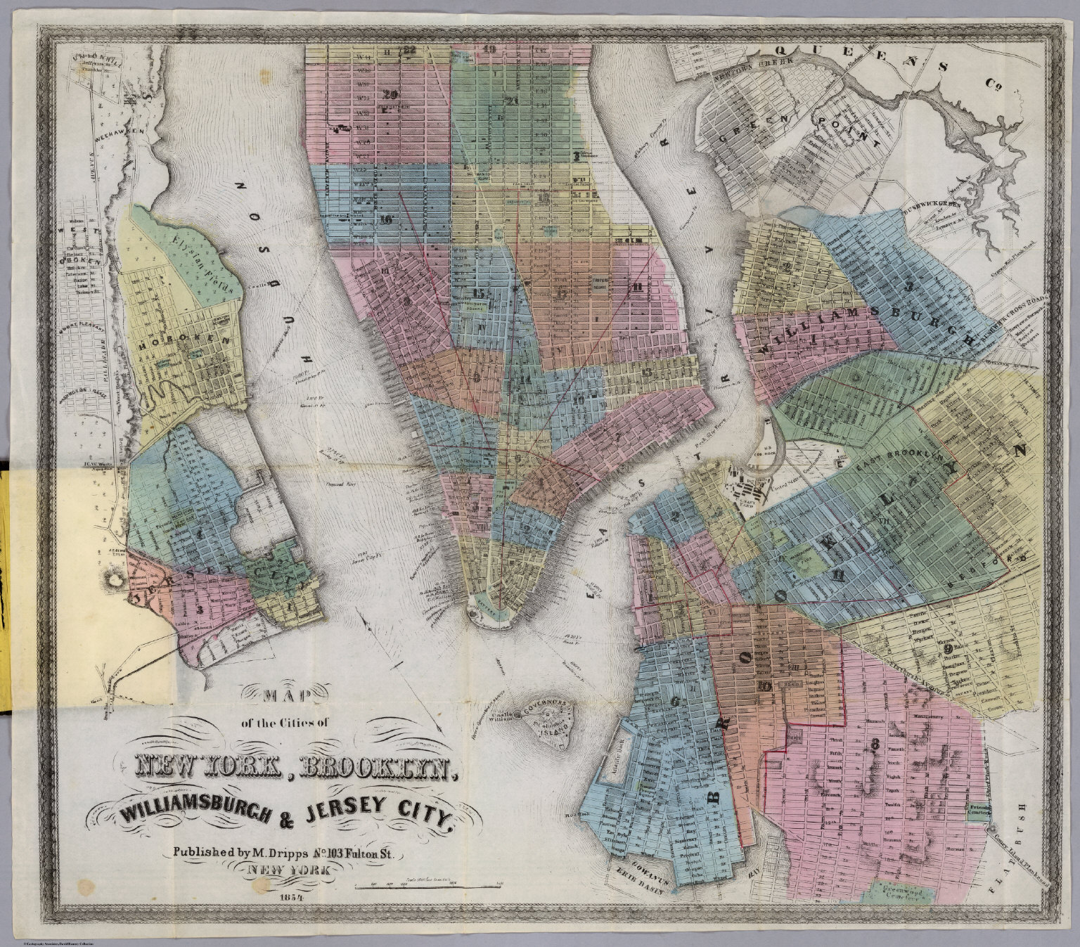
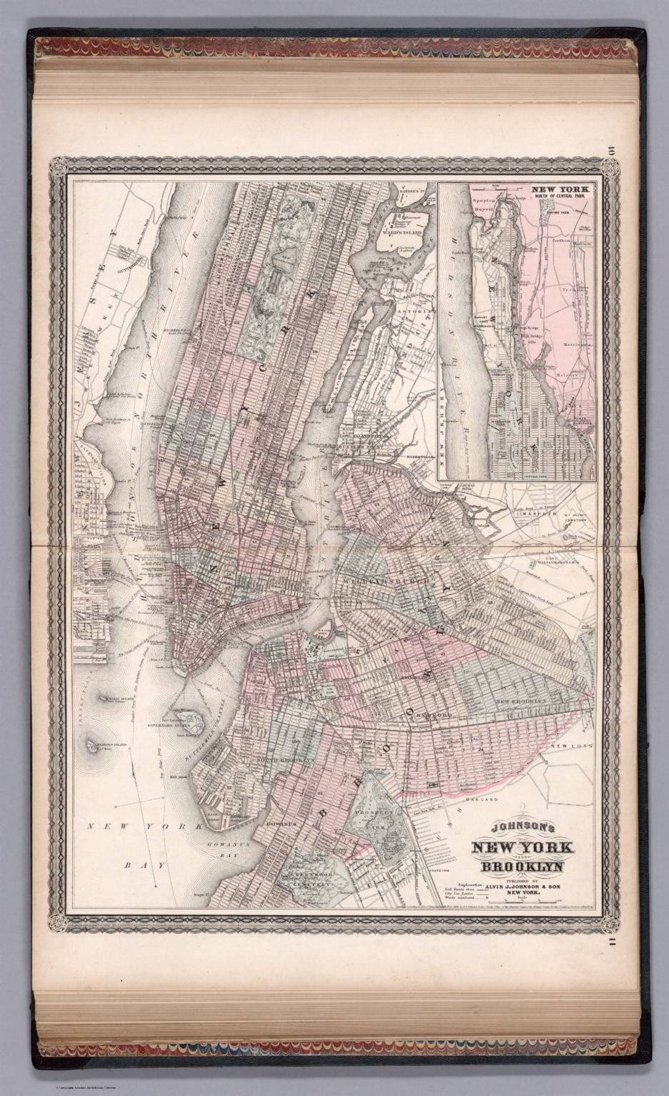
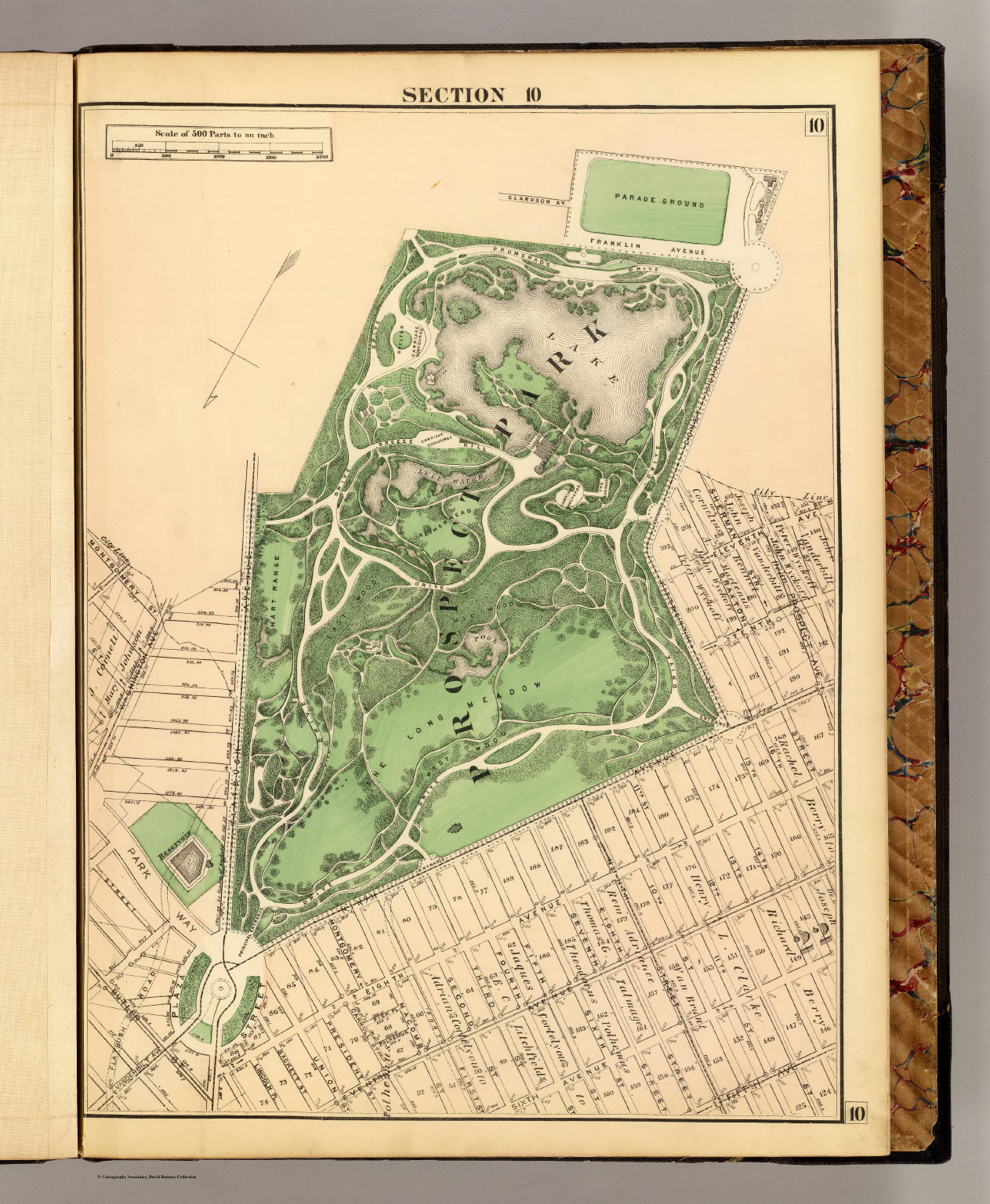
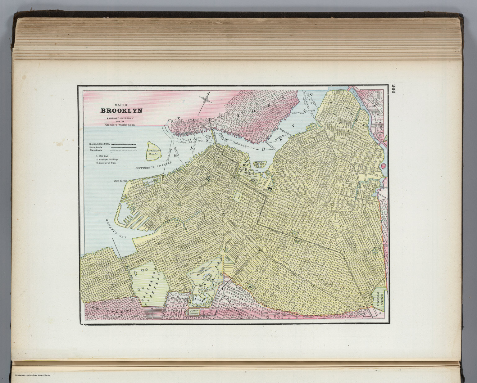
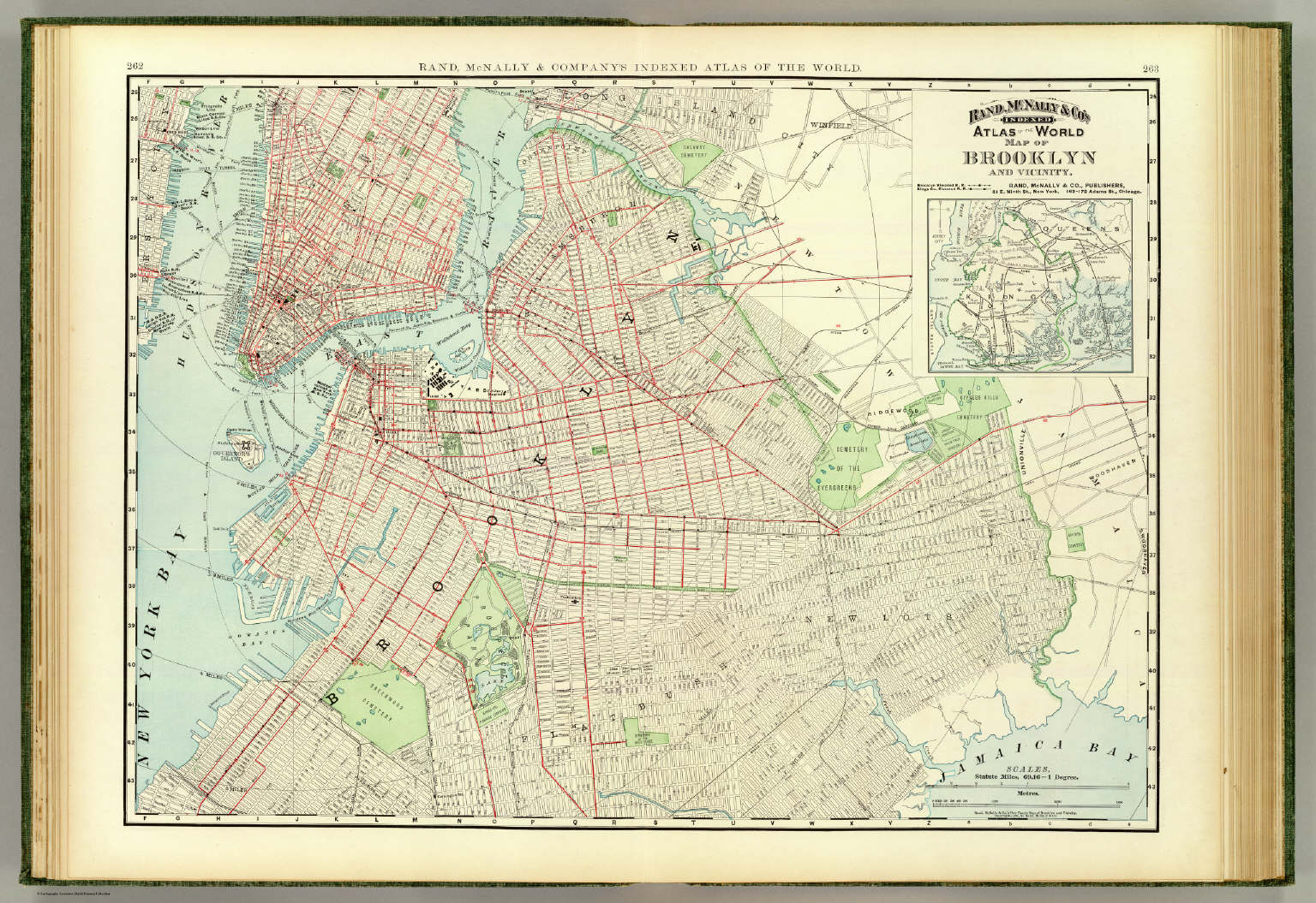
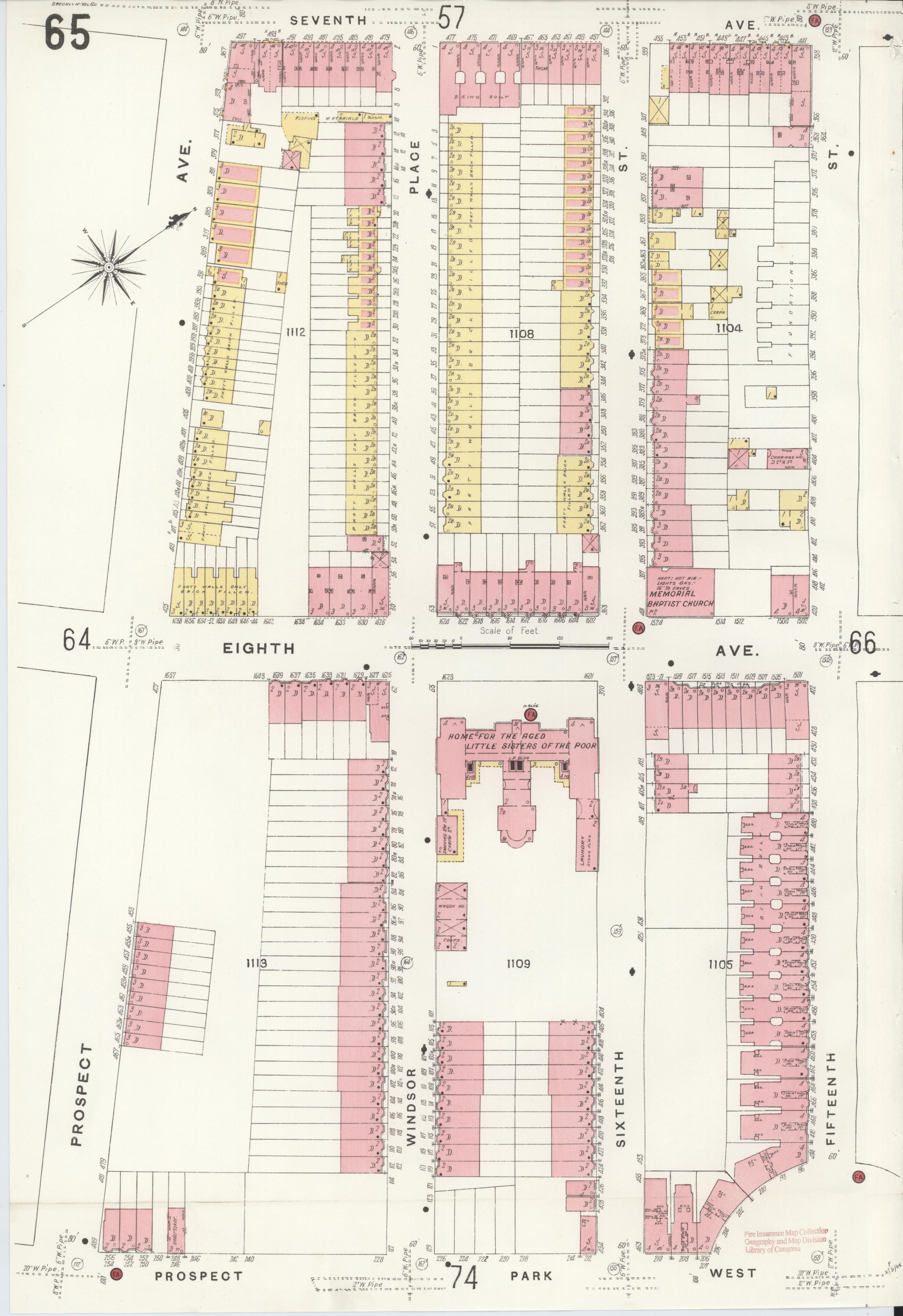
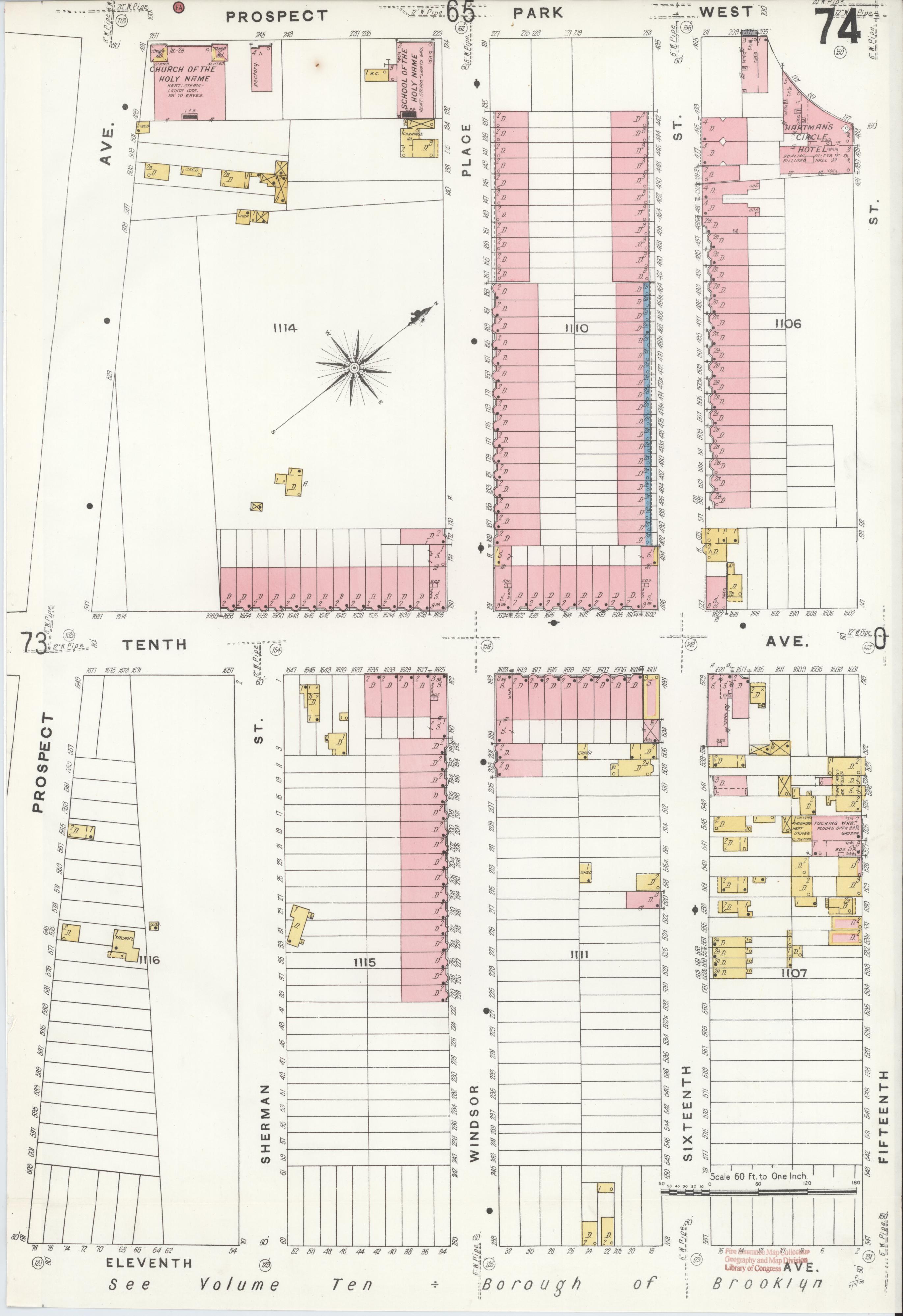
Sources: David Rumsey Map Collection (1854 Dripps, 1866 Johnson, 1874 Fulton Section 10, 1889 Standard World Atlas, 1897 Rand-McNally) and Library of Congress Sanborn Map Collection (sanborn05791_018, 1906 Vol 6, Sheets 65 + 74). OCR via Gemini 2.5 Pro on Vertex AI; cost ~$0.20 per map. Image files in public/findings/maps/.